Landslide and Mudslide Survival: How to Read the Warning Signs Before the Hillside Gives Way
Debris flows can bury a house in seconds and give almost no notice. Learn how to assess your slope risk, recognize the warning signs, and evacuate before the ground moves.
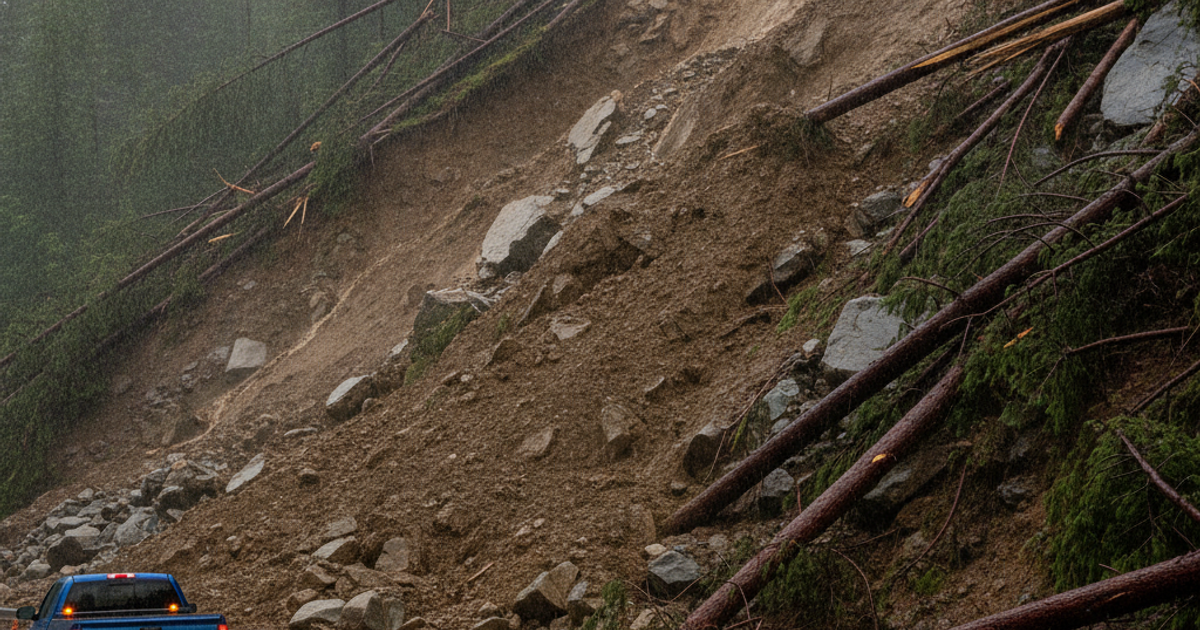
Landslides don't get the headlines that hurricanes and wildfires do, but they kill people in all 50 states. The U.S. Geological Survey estimates that landslides and debris flows cause 25 to 50 deaths annually in the United States and between $1 billion and $2 billion in damages every year. The deadliest single event in modern American history wasn't a tornado outbreak — it was the Oso, Washington landslide of March 22, 2014, which buried a neighborhood in seconds and killed 43 people. Most of the victims had no idea the hill above them was unstable.
Here's the uncomfortable truth for preppers: a landslide is one of the few disasters that can destroy your home, your stockpile, and your family in under 60 seconds with essentially zero warning from authorities. There is no landslide siren. There is no National Landslide Center issuing warnings for your street. The warning system is you — your eyes, your situational awareness, and your willingness to act on subtle clues that most people dismiss as "just settling."
This guide covers slope risk assessment, drainage control, the specific physical warning signs of ground movement, evacuation planning, and the badly underestimated threat of post-wildfire debris flows — for homeowners, renters, apartment dwellers, and rural landowners alike.
What You'll Need
Tools
- Digital inclinometer or slope gauge
- Crack monitor gauges
- Cordless reciprocating saw
- Shovel, pick mattock, and a stiff-bristle drain brush
Supplies
- NOAA weather alert radio
- Wireless rain gauge
- Sandbags
- 6-mil poly sheeting
- Rebar stakes, wooden survey stakes, and spray paint
How to Assess Whether Your Property Sits in a Landslide Zone
Slope failure requires three ingredients: gradient, saturated or weak soil, and a trigger. Slopes steeper than roughly 15 degrees begin to carry meaningful risk, and anything above 30 degrees should be treated as actively dangerous during heavy rain. A Johnson Level digital inclinometer lets you measure the actual angle of the hillside behind or below your home instead of guessing — lay it on a straight board set against the slope and record the reading in several locations.
Beyond gradient, look for these red flags:
- Historic slide evidence — hummocky, lumpy ground; curved "pistol-butt" tree trunks; crescent-shaped scarps on the hillside above you.
- Cut-and-fill construction — homes built on engineered pads where soil was cut from the uphill side and dumped on the downhill side. Fill soil fails first.
- Old retaining walls — bulging, leaning, or weeping walls are structures already losing the fight.
- Drainage convergence — your home sitting at the mouth of a swale, gully, or canyon that funnels runoff.
Pull your county's landslide hazard map, the USGS national landslide inventory, and FEMA flood maps. In urban and suburban areas, also check city geotechnical records — California, Washington, Oregon, Colorado, and much of Appalachia maintain detailed slope-stability overlays. Renters have every right to ask: if you live in a hillside apartment complex or a daylight-basement unit cut into a slope, ask management when the retaining walls and subsurface drains were last inspected.
Drainage and Erosion Control: The Cheapest Landslide Insurance You Can Buy
Water is the trigger in the overwhelming majority of slope failures. Saturated soil loses cohesion and gains weight — a double hit to stability. Controlling where water goes is the single highest-return action you can take.
- Never discharge water onto a slope. Downspouts, sump pumps, and French drains must pipe water to a stable outlet, not dump it over the hillside edge.
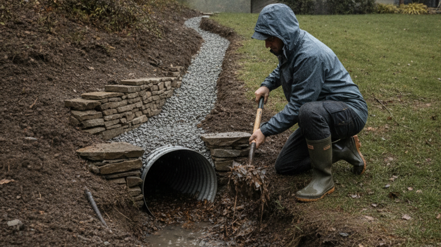
- Clear culverts and ditches before the wet season. A plugged culvert turns a drainage into a reservoir.
- Fix leaking irrigation and water lines immediately. Slow leaks have caused multimillion-dollar slides.
- Keep deep-rooted vegetation on slopes. Native shrubs and trees act as rebar. Clear-cutting a hillside for a view is a documented slide accelerant.
- Build diversion berms uphill of structures to steer sheet flow around, not into, the building pad.
For active storm response, keep sandbags and 6-mil poly sheeting on hand. Anchored plastic sheeting over a bare or cracked slope prevents rainfall from infiltrating into tension cracks, and sandbag berms redirect debris flows away from doors and garage openings. Twenty sandbags and a roll of poly stored in the garage cost less than a tank of gas and have saved houses. If you've already prepped for flooding and rising water, you likely own most of this already.
How to Recognize Landslide Warning Signs Before the Ground Gives Way
Slopes almost always talk before they move. Learn the vocabulary.
Structural signs inside and around the building
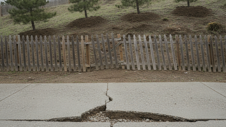
- New or widening cracks in foundations, slabs, driveways, sidewalks, or stucco
- Doors and windows that suddenly stick or show gaps at the top corners
- Floors sloping, tile grout cracking in lines, stair-step cracks in masonry
- Decks, patios, or porches pulling away from the main structure
- Broken water lines or utility connections with no obvious cause
Mark and monitor every crack. Cheap crack monitor gauges epoxied across a foundation crack give you a precise millimeter readout of movement over weeks. A static crack is cosmetic. A crack that grows 2 mm in a rainy month is a geotechnical emergency.
Ground and vegetation signs
- Tilting trees, fence posts, retaining walls, or utility poles
- New springs, seeps, or saturated patches where ground was always dry
- Soil pulling away from foundations or bulging at the base of a slope
- Creek water suddenly turning muddy, or stream flow dropping sharply (upstream blockage) or surging
- Fresh tension cracks curving across the hillside above you
Imminent-failure signs — leave now
A low rumble that builds in volume. Trees cracking and boulders knocking. Fences, trees, or power lines moving downslope. Water running brown and chunky. Debris flows travel at 10 to 35 mph, and some exceed 50 mph. You cannot outrun one downhill. You move laterally, out of the flow path, and uphill to high ground.
Post-Wildfire Debris Flow: The Deadliest Window Most People Miss
This is the risk preppers consistently underestimate. Wildfire destroys root structure and bakes a water-repellent (hydrophobic) layer into the soil. The burned ground sheds rain like pavement. USGS research shows debris flow risk in a burn scar is elevated for two to five years after a fire, with the first rainy season the most dangerous.
The threshold is shockingly low: rainfall intensity of roughly 0.5 inch per hour — or even less in severely burned terrain — can trigger a destructive debris flow. On January 9, 2018, about 15 minutes of intense rain over the Thomas Fire burn scar produced the Montecito, California debris flow that killed 23 people and destroyed more than 100 homes. Many victims were outside the mandatory evacuation zone.
If you live downstream of any burn scar, even miles away, treat every heavy rain cell as a potential evacuation. A wireless rain gauge with a console inside your house lets you see real-time rainfall rate instead of guessing — if you're watching a half-inch accumulate in under an hour, you leave. Pair that with a Midland WR120 NOAA weather alert radio programmed to your county SAME code so flash flood warnings wake you at 3 a.m. Those warnings are the closest thing to a landslide alarm that exists. Readers who've already worked through our wildfire defensible space guide should add burn-scar debris flow planning as the mandatory second half of that plan.
Step-by-Step Instructions
Step 1: Map your slope and drainage within 300 feet
Walk your property and the terrain uphill and downhill of it. Measure slope angles with an inclinometer, sketch where water flows during a heavy storm, and photograph every retaining wall, culvert, and existing crack. Apartment dwellers should do this for the complex grounds and identify which units sit in the direct flow path.
Step 2: Install crack monitors and reference stakes
Epoxy crack gauges across any foundation or wall crack wider than a credit card edge. On open slopes, drive rebar or survey stakes in a straight line across the hillside and photograph them monthly — if the line bends, the slope is creeping.
Step 3: Clear and reroute every drainage path before wet season
Clean gutters, culverts, roadside ditches, and area drains. Extend downspouts to solid outfalls away from slope edges. Repair leaking irrigation lines and redirect sump discharge off the hillside entirely.
Step 4: Stockpile and stage slope-protection materials
Keep sandbags, poly sheeting, stakes, and a shovel where you can reach them in the dark and the rain — not buried behind the Christmas decorations. Pre-fill at least a dozen sandbags so you're not shoveling wet sand during the storm.
Step 5: Set weather alerts and monitor rainfall intensity
Program a NOAA alert radio to your county, enable Wireless Emergency Alerts on every phone, and install a rain gauge. Establish a hard family trigger: a certain rainfall rate, or a flash flood warning in a burn scar, means you go without debate.
Step 6: Build two evacuation routes that avoid the flow path
Map a primary and secondary route out that does not cross drainages, canyon mouths, or the base of the slope. Debris flows follow channels — your escape must get you laterally out of the channel and onto high ground.
Step 7: Rehearse a 10-minute grab-and-go evacuation
Time your family doing it. Bug out bags staged by the door, vehicle backed in and fueled above half a tank, pets crated, documents in a grab bag. Practice it at night, in the rain, at least twice a year.
Step 8: Document everything for insurance and recovery
Standard homeowner's policies almost never cover earth movement, and flood policies exclude most landslide damage. Photograph your home's interior and exterior annually, store copies off-site or in the cloud, and investigate difference-in-conditions coverage if you're in a mapped hazard zone.
What to Do During and After a Landslide
If a slide starts and you cannot escape, move to the second floor or an interior room on the uphill side of the structure and curl into a tight ball to protect your head and neck. After the ground stops moving, stay away from the slide area — secondary failures are common and have killed rescuers.
Shut off gas and electricity if you can do so safely before evacuating; our guide to emergency utility shutoff covers the procedure. Post-slide cleanup almost always involves cutting through downed trees, broken framing, embedded fence wire, and debris. A DeWalt 20V MAX cordless reciprocating saw with wood/metal blades is the most versatile rescue and extraction tool you can own when there's no power and a chainsaw is overkill or too dangerous in mud-packed debris. For larger timber, see our guide to clearing storm debris safely.
Recommended Gear
Communications matter more than most people expect after a slide, because roads fail and cell sites on hilltops go down. A Kaito KA500 solar hand-crank emergency radio keeps you receiving NOAA broadcasts and AM/FM emergency information indefinitely without batteries, and its USB port will trickle-charge a phone. Add it to your 72-hour bug out bag alongside your water purification tablets, headlamp, and emergency food. Browse our full recommended survival gear list to fill remaining gaps.
Frequently Asked Questions
What are the first warning signs of a landslide?
The earliest signs are usually subtle structural changes: new cracks in foundations, driveways, or walls; doors and windows that suddenly stick; and decks pulling away from the house. Outdoors, watch for tilting trees and fence posts, new springs or wet spots, and soil bulging at the base of a slope. Imminent failure sounds like a growing rumble and cracking timber — if you hear it, evacuate laterally and uphill immediately.
How long after a wildfire is debris flow a risk?
USGS research indicates elevated debris flow risk for two to five years after a fire, with the first post-fire rainy season being by far the most dangerous. Rainfall intensity of about half an inch per hour can trigger a flow in a severely burned watershed. Vegetation recovery gradually restores soil stability, but you should treat every intense rain cell over a burn scar as an evacuation trigger until agencies declare the watershed recovered.
Can apartment renters do anything about landslide risk?
Yes. Renters can't rebuild retaining walls, but they can check county hazard maps before signing a lease, request maintenance records on slope drainage, document existing cracks with dated photos, keep a NOAA alert radio and a packed bug out bag, and pre-plan an evacuation route that avoids drainage channels. Renters insurance is cheap and should be reviewed for earth-movement exclusions. Choosing an upper-floor unit on the uphill side of a complex is a meaningful risk reduction all by itself.
Affiliate Disclosure: SHTFPlan.net participates in the Amazon Services LLC Associates Program. Some links are affiliate links — we may earn a small commission at no extra cost to you.