Dam Failure and Levee Breach: How to Survive the Flood Wave When the Barrier Gives Way
More than 16,000 U.S. dams are rated high-hazard, and most people downstream have no idea they live in the inundation zone. Here's how to find out — and how to survive a breach.
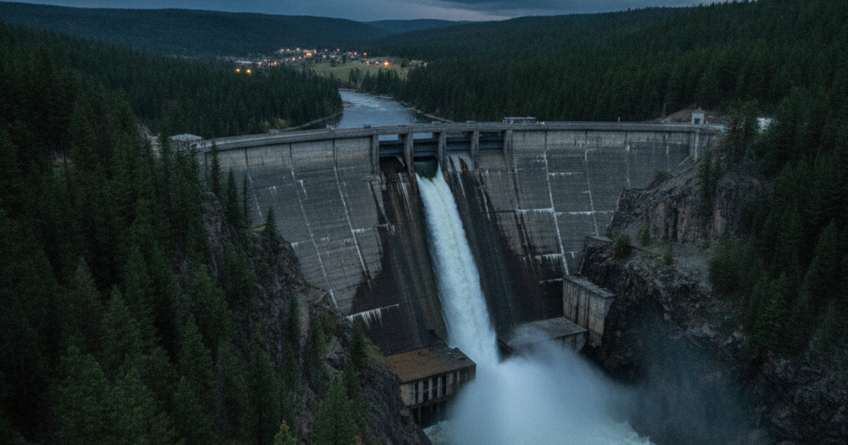
There are roughly 92,000 dams in the U.S. National Inventory of Dams, and more than 16,000 of them carry a "high hazard potential" rating — meaning failure would likely kill people. The average American dam is over 60 years old, and the American Society of Civil Engineers has repeatedly graded the nation's dams a D. Levees fare no better: roughly 30,000 miles of leveed embankments protect an estimated 17 million Americans, and much of that system was built to agricultural standards decades ago, not to hold back a modern 500-year flood.
A dam or levee failure is not a flood in the normal sense. A river flood creeps up over hours or days. A breach releases stored energy — a moving wall of water, mud, trees, vehicles, and structural debris that can arrive with almost no warning. When Idaho's Teton Dam failed in 1976, the reservoir drained in roughly six hours and scoured entire towns. When the Edenville and Sanford dams failed in Michigan in May 2020, 10,000 people evacuated in a matter of hours. The 2017 Oroville spillway crisis pushed 188,000 people out of their homes with about an hour's notice.
Surviving that event is not about gear or grit. It's about knowing in advance whether you're standing in the inundation zone, recognizing the structure's distress signals, and moving uphill before everyone else figures it out.
How to Find Out If You Live in a Dam Inundation Zone

Most people who die in dam failures had no idea they lived downstream of one. Do this research tonight, not during an emergency.
- National Inventory of Dams (nid.sec.usace.army.mil) — search by state or county. Note every dam upstream of you, its hazard classification, height, and storage volume.
- National Levee Database (levees.sec.usace.army.mil) — identifies leveed areas and the population behind them.
- Your state dam safety office — every high-hazard dam should have an Emergency Action Plan (EAP) with an inundation map showing flood depth and wave arrival time. Some are restricted, but counties often share them with residents.
- FEMA Flood Map Service Center — useful, but remember FEMA maps generally do not model dam-break scenarios. The real inundation footprint can be far larger.
Then do it the old-fashioned way: look at a topographic map. Find your elevation, find the reservoir's elevation, and trace the valley. If you're in the floodplain below a reservoir, you're in the zone — regardless of what any map says. Apartment dwellers in river-adjacent urban cores should pay special attention: a 10-foot flood wave through a downtown street grid becomes a channelized torrent moving faster than it would across open farmland.
What You'll Need
Tools
- NOAA weather alert radio with SAME county coding
- Handheld GPS with topographic mapping
- Vehicle escape tool (window breaker and seatbelt cutter)
- Waterproof LED flashlight
Supplies
- Type III PFDs for every household member
- Waterproof headlamps
- Printed topographic map with marked high-ground routes
- Grab-and-go bug out bag with documents in dry bags
Pre-Breach Warning Signs: How to Read a Dam or Levee in Distress
Engineers call it "piping" — water finding a path through or under an earthen embankment, enlarging that path with every second of flow. Most earthen dam and levee failures announce themselves 30 minutes to several hours before full collapse. If you live near a levee or earthen dam, walk it occasionally during high water and know what to look for:
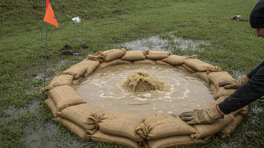
- Sand boils — cone-shaped bubbling springs of water and sediment on the dry side. Clear water is concerning; muddy water means the embankment is eroding internally. This is a red alert.
- New seepage or wet, spongy ground at the toe of a levee or dam that wasn't there yesterday.
- Cracks, slumps, or bulges in the crest or slope; sudden settlement of the roadway on top.
- Whirlpools or swirling water on the reservoir side, indicating flow entering the structure.
- Sudden change in flow volume downstream — either an unexplained surge or an abrupt drop.
- Rumbling, cracking, or roaring noises. Johnstown survivors in 1889 described the sound as a freight train before anything was visible.
- Overtopping — water flowing over the crest. Earthen structures typically fail within minutes to a few hours once this begins.
Report any of these to 911 and your local emergency manager immediately — and then leave. Do not wait for confirmation. The same situational awareness discipline that serves you in threat detection applies to infrastructure: trust the anomaly.
How Fast Does a Dam Break Flood Wave Travel?
Speed depends on reservoir volume, breach size, and valley slope — but in steep terrain, a flood wave can move 10 to 30 miles per hour. In the 1976 Teton failure, the wave reached Wilford, six miles downstream, in roughly 45 minutes and effectively erased it. Flat terrain slows the wave but widens it, flooding far more area.
Two numbers to burn into memory: six inches of moving water can knock an adult down, and 12 to 18 inches will float most vehicles. The National Weather Service attributes well over half of all flood fatalities to people in vehicles. Your truck is not a boat.
Step-by-Step Instructions
Step 1: Identify every dam and levee upstream of you
Use the National Inventory of Dams and National Levee Database to list structures within 50 miles upstream. Record hazard classification and your own elevation above the river. Call your county emergency management office and ask specifically for the inundation map and estimated wave arrival time for your address.
Step 2: Map three high-ground escape routes
Your target is perpendicular to the valley, uphill — not downstream along the river road, which is where the water is going. Identify a destination at least 50 feet above river level or outside the mapped inundation boundary. Drive all three routes in daylight and again at night. Urban readers should include on-foot options, since city evacuation routes gridlock within minutes.
Step 3: Program and test your alert systems
Enroll in your county's reverse-911/mass notification system, enable Wireless Emergency Alerts on every phone, and set up a SAME-coded NOAA radio for your county. Keep a hand-crank emergency weather radio as backup — dam failures routinely take out substations and cell sites along the river corridor.
Step 4: Stage a flood-specific go bag by the door
Dry bags, PFDs, headlamps, medications, and your grab-and-go vital documents kit. Keep it within ten seconds of the exit. Time spent gathering is time the wave is using to close distance.
Step 5: Evacuate on the warning, not the water
When an evacuation order, a siren, or a confirmed sign of distress occurs, leave immediately with what's already packed. Shut off utilities only if you can do it in under 60 seconds — review emergency utility shutoff procedures in advance. Do not stop for valuables, pets left loose, or neighbors' debates.
Step 6: Refuse to drive through moving water
Turn around, don't drown. If you misjudge and water rises around the car, unbuckle, break the side window immediately, and get out — doors won't open against water pressure. Keep an escape tool clipped to the key ring or visor, not buried in a glove box.
Step 7: Climb up, never down, if you're trapped
If the wave beats you, go to the highest floor or roof — but avoid sealed attics with no exterior exit. Take a signaling light, a whistle, and an axe or pry bar if available. Apartment dwellers above the third floor are often safest sheltering in place, though you should expect days without power, water, or elevators.
Step 8: Stay out until the structure is declared stable
Secondary surges, upstream cascade failures, and saturated foundations kill people during the "all clear" window. Assume floodwater carries sewage, fuel, and chemicals, and treat all water as contaminated until purified.
Recommended Gear for Flood Wave Survival
Most flood deaths come down to being in the wrong place with the wrong equipment. A Type III life vest stored in a hall closet costs less than a tank of gas and keeps a non-swimmer's head above water during a chaotic nighttime evacuation. For adults who'll resist wearing bulky gear, a low-profile inflatable belt pack PFD is far more likely to actually be worn. Add a waterproof headlamp per person for hands-free movement, a submersible LED flashlight for signaling, and a topo-capable handheld GPS so you can find high ground when road signs are underwater. Rural readers with river access should also review small boat bug-out options — though a dam-break wave is never the time to launch. See our full recommended survival gear list for additional flood-rated equipment.
Frequently Asked Questions
How do I know if my house is downstream of a high-hazard dam?
Search the National Inventory of Dams by county, then contact your state dam safety program or county emergency manager and request the Emergency Action Plan inundation map for your address. Some maps are security-restricted, but officials can usually tell you whether your property falls inside the modeled flood footprint and your estimated wave arrival time.
How much warning will I get before a dam or levee fails?
It varies enormously. Earthen structures showing piping or overtopping may give 30 minutes to several hours of visible distress. Concrete dams can fail with essentially zero warning. Official notification depends on whether the dam has a functioning EAP and whether your county's alert system reaches you — which is why a SAME-coded NOAA radio and enabled Wireless Emergency Alerts are non-negotiable.
Is it safer to evacuate or shelter in place during a dam break?
Evacuate early if you have any lead time — vertical escape is a last resort, not a plan. But if the wave is already arriving, do not get in a vehicle. Move to the highest floor or roof of the sturdiest structure available, bring light and signaling tools, and avoid attics without exterior access. Review our full flood survival and recovery guide for post-event water purification and cleanup protocols.
Affiliate Disclosure: SHTFPlan.net participates in the Amazon Services LLC Associates Program. Some links are affiliate links — we may earn a small commission at no extra cost to you.